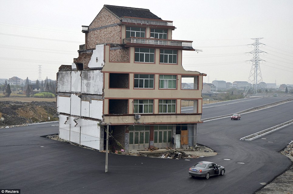
This is what happens when you combine a building and a highway:
Or this:
But it doesn’t have to be this way.
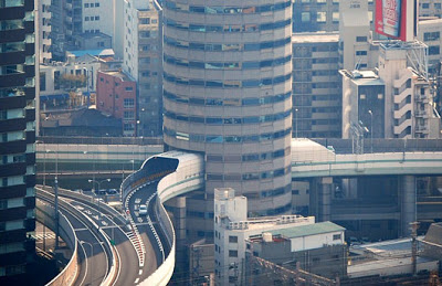
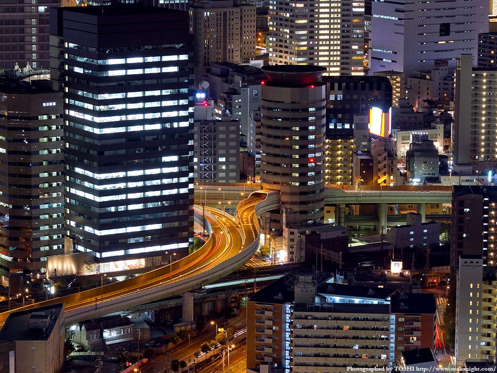
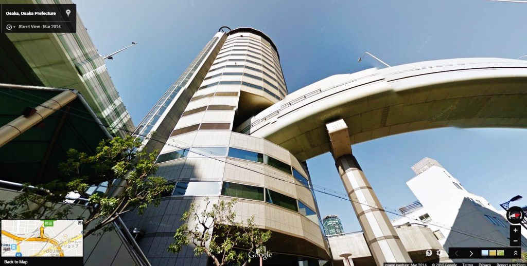
Consider the TKP Gate Tower Building TKPゲートタワービル in Osaka 大阪 , also known as The Beehive「ビーハイブ」/「蜂の巣」 (Google maps). The Gate Tower building is an efficient use of dense urban space, and presumably was the result of a great deal of planning between public and private interests, the road developers and the building owners. Such coordination was clearly lacking in the two images at the top of this post.
Despite the elegance of the Gate Tower Building, the building site is dominated by the highway. I’ve never visited this part of Osaka, but Google Street View depicts a streetscape of wide roads and looming overpasses. I may end up visiting this site due to its proximity to Osaka Station 大阪駅, but I doubt I’ll linger. This isn’t the most picturesque part of town. (photo source left, right)
It still is pretty impressive:
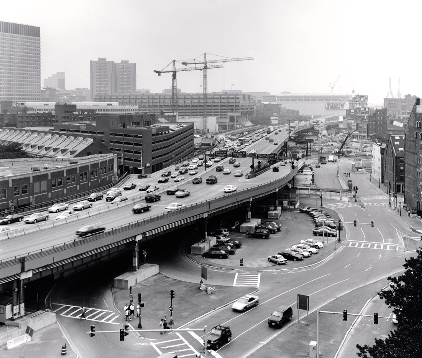
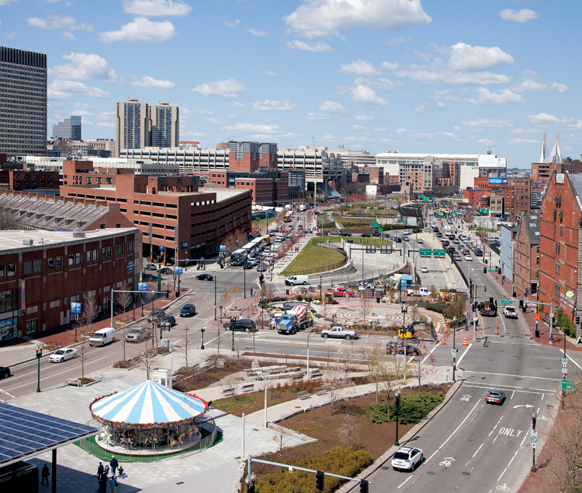
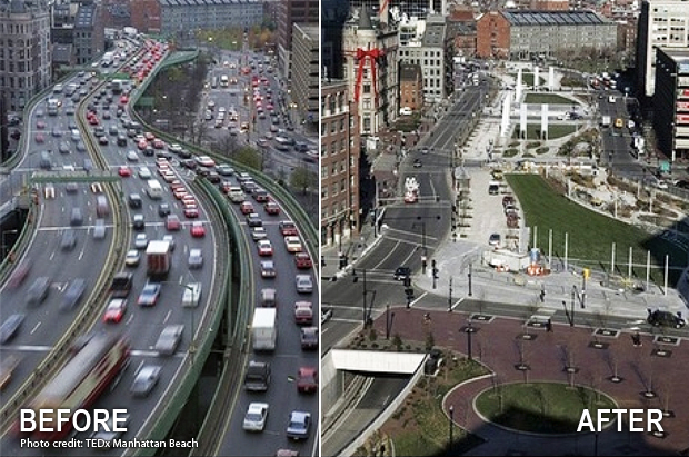
Highways are rarely considered conducive to pedestrian-friendly cities, a fact lost on a generation of Americans. In America, the tide may have turned around the time of the Big Dig, which broke ground in 1991. This mega-project was widely criticized for its staggering cost, yet its impact on the city of Boston is quite noticeable, and the project is now considered a success by many. One of the defining elements of the Big Dig was to move the Central Artery(Interstate 93) underground in order to improve traffic flow and improve the aesthetics and walkability of the downtown, as seen in various before-and-after photographs.
Boston’s Big Dig, before and after:
And this: 1
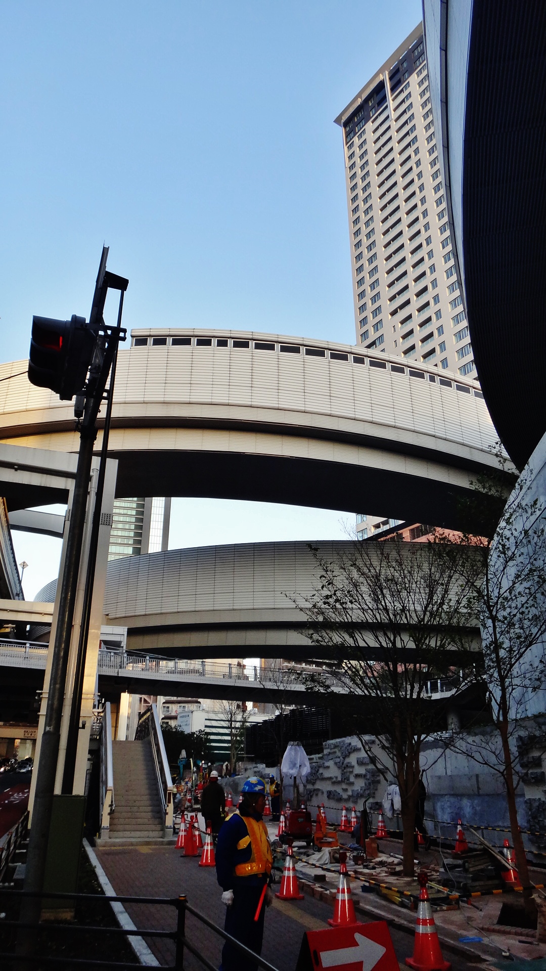
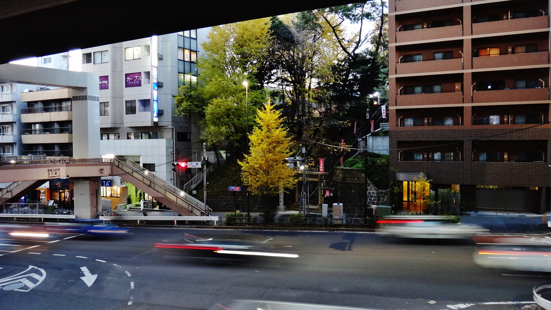
Tokyo, despite its hyper-density, has not been as deeply traumatized by highways as American cities, with the famous exception of the “tragedy” of Nihonbashi Bridge 2 3 4. To a lesser degree I cringe at the overbearing elevated highways the straddle such roads as Roppongi-dori (Street View) or Tamagawa-dori 玉川通り in Sangenjaya 三軒茶屋 (Street View).
The project
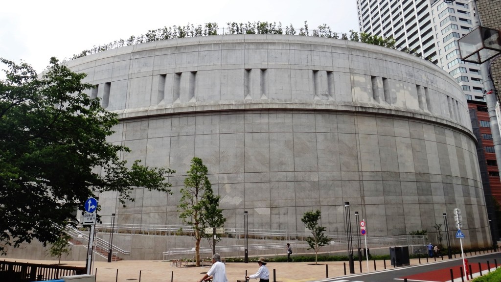
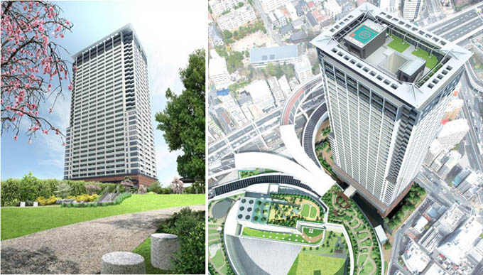
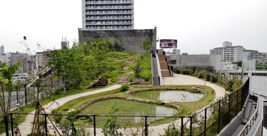
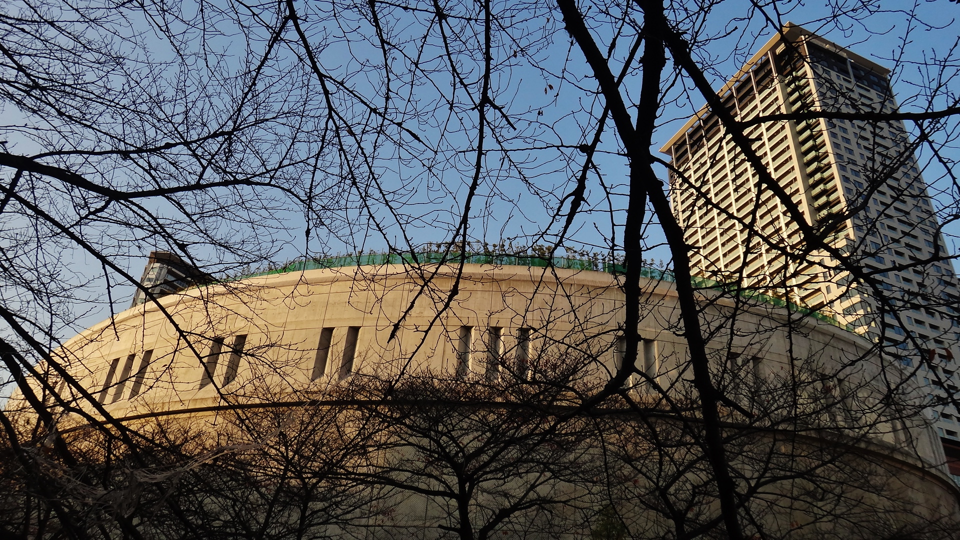
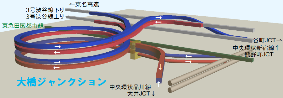
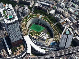
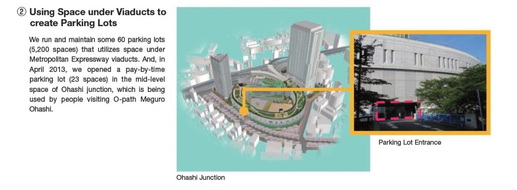
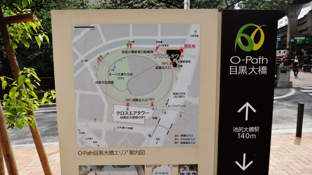
A recent project in Tokyo shows you can have your highway and eat quietly beside it too. One mile southwest of Shibuya Station, thousands of cars spiral through Ohashi Junction without disturbing the peace of the neighborhood. The site is named “O-Path Meguro Ohashi”「O-Path目黒大橋」, in reference, I assume, to the oval shape of the junction (Note 2). The site is also called Ohashi Green Junction 大橋グリーンジャンクション due to “green” elements of the project such as the park that sites on the roof of the structure.
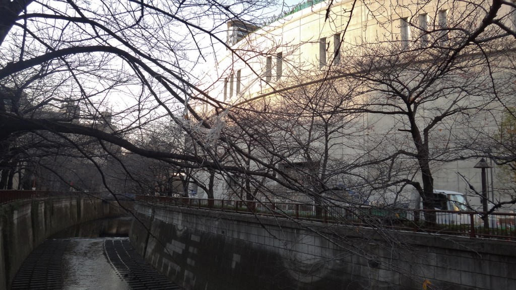
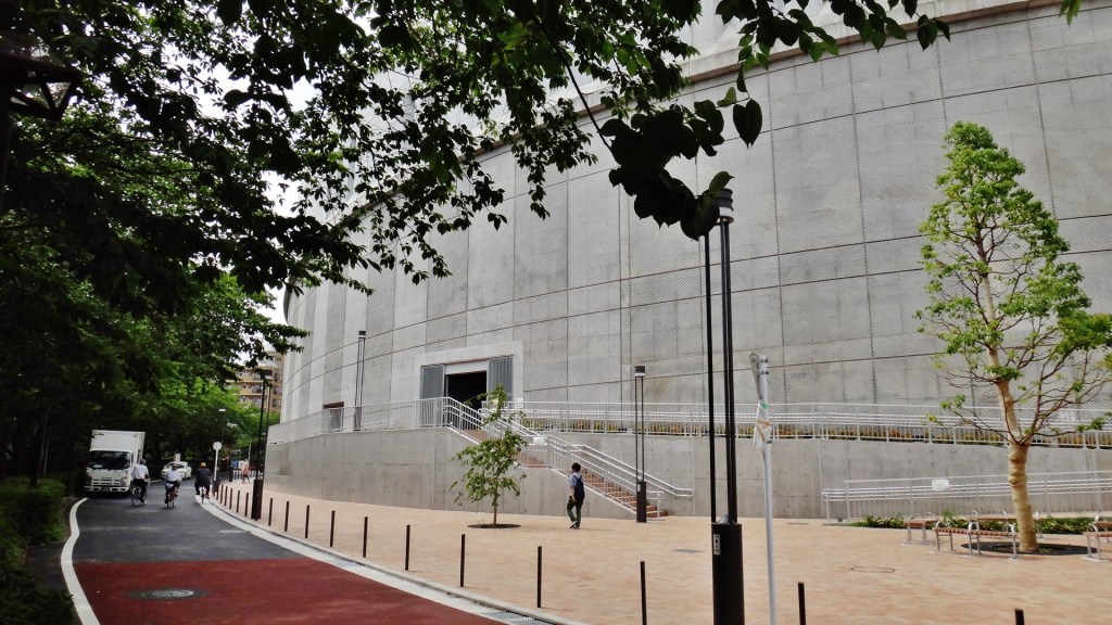
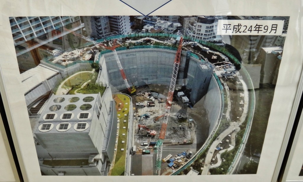
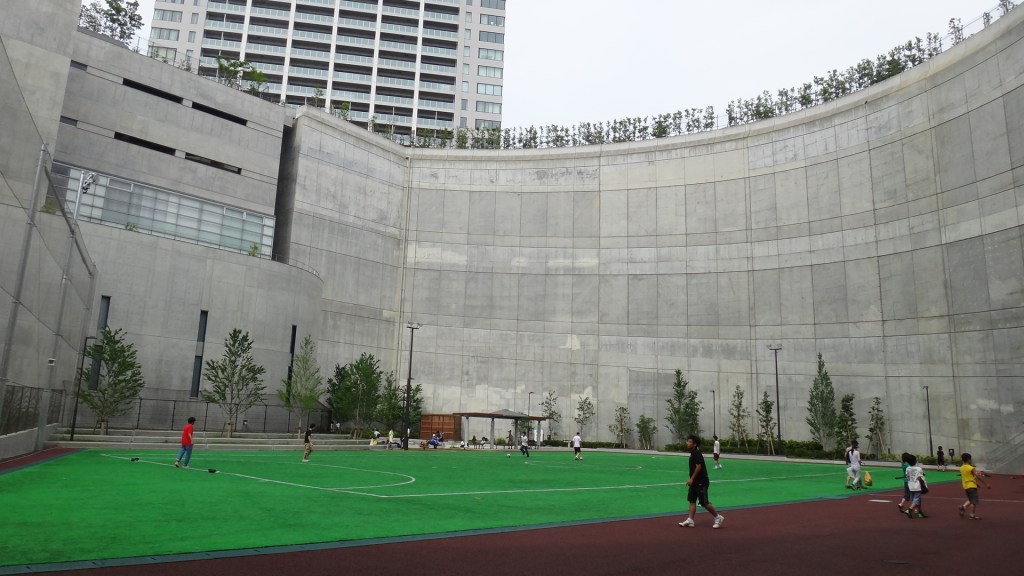
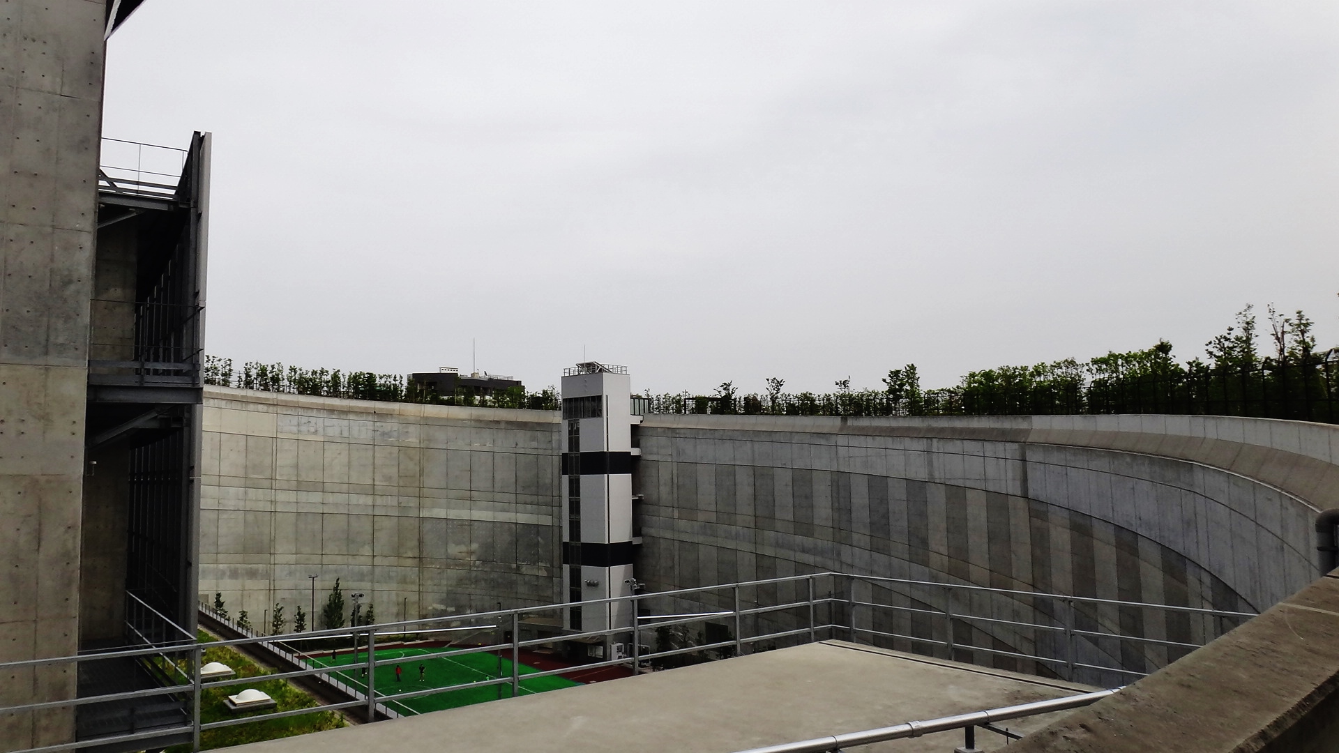
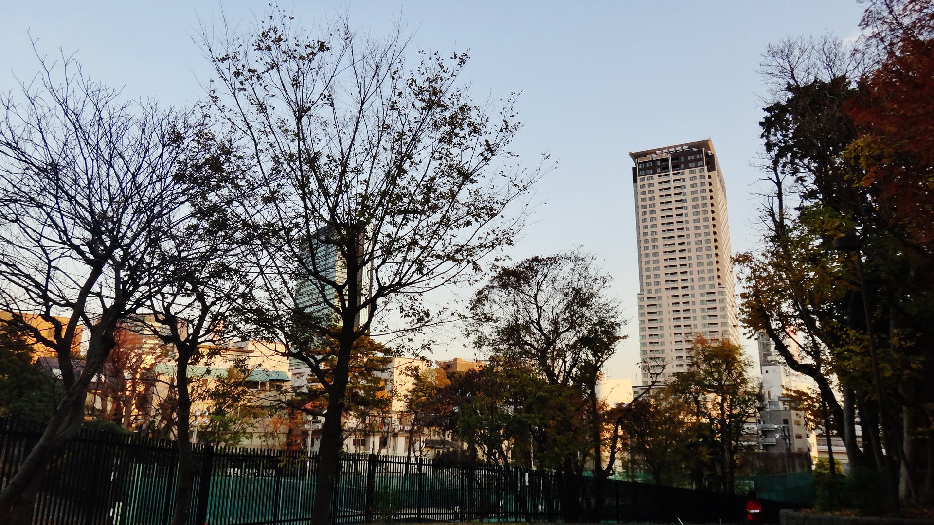
In the middle of the oval, at ground-level, is a soccer field. And connected to the oval, on opposite sides, are two luxury condominiums: the 27-story Prism Tower and the 42-story Cross Air Tower. The photos below show the outside of the oval, as seen from the beautiful Meguro River 目黒川 to the south. When I first walked by the construction site in June 2012, I saw the huge curved wall and had no idea that a highway would be placed inside. Even upon completion in 2013, a pedestrian would have no idea that hundreds of cars were zipping through the walls just meters away.
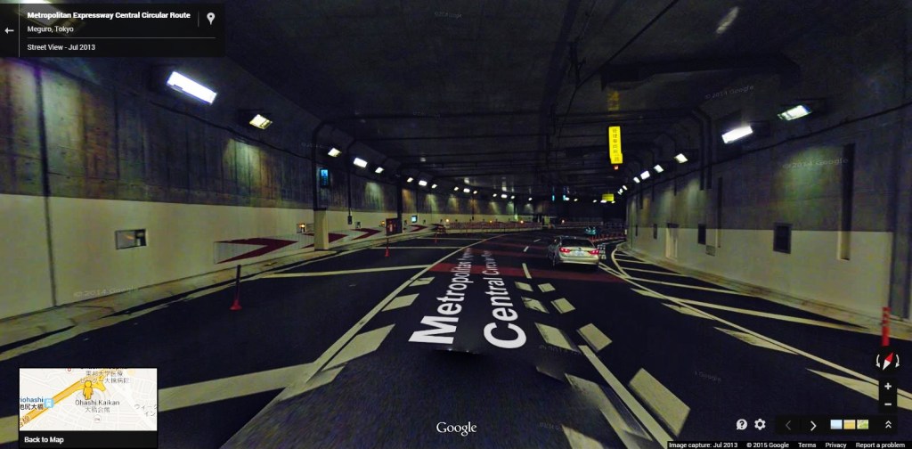
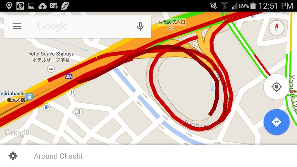
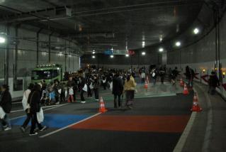
The picture below shows the inside of the junction, and a map showing heavy traffic in red:
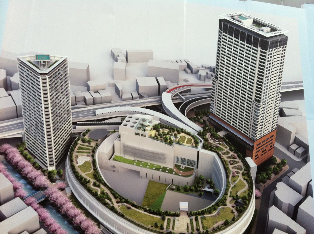
Construction and artist’s renderings
When I first saw the project in May 2012 I took a few pictures of the artist’s renderings that adorned the construction site (see below for two of them). The project looks impressive, both futuristic and beautiful, especially because of the green grass and trees that are a welcome contrast from the surrounding cityscape.

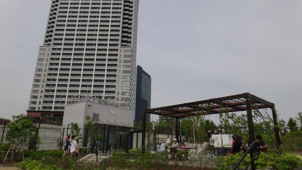
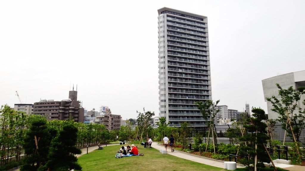
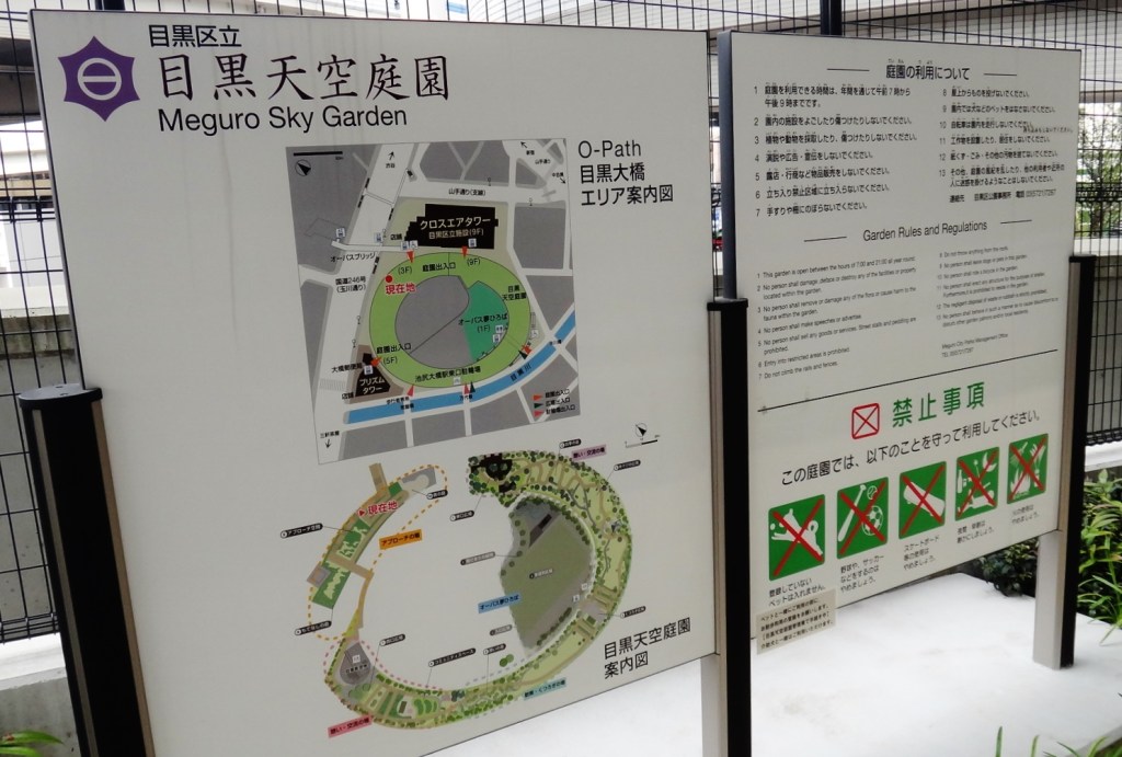
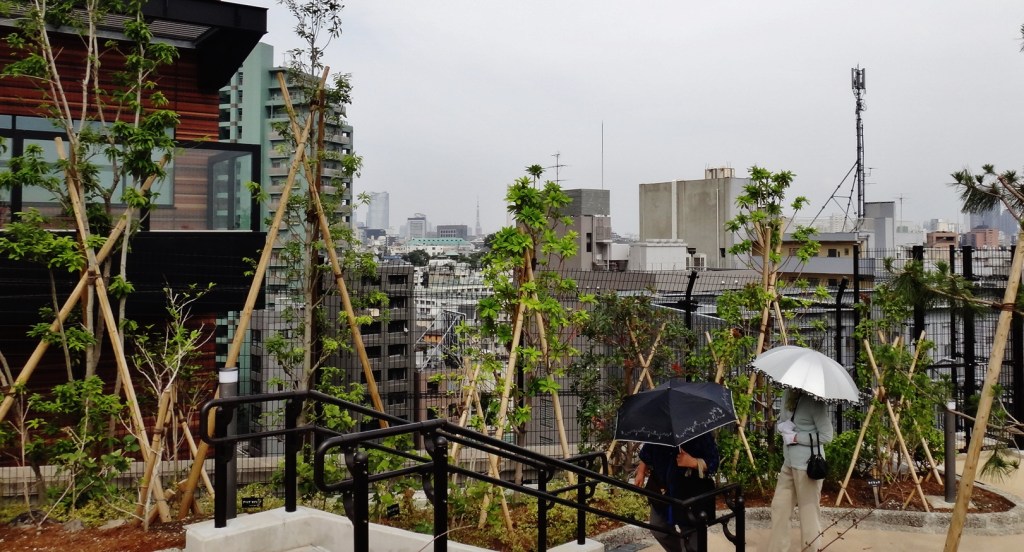
The rooftop garden / Meguro Sky Garden 目黒天空庭園
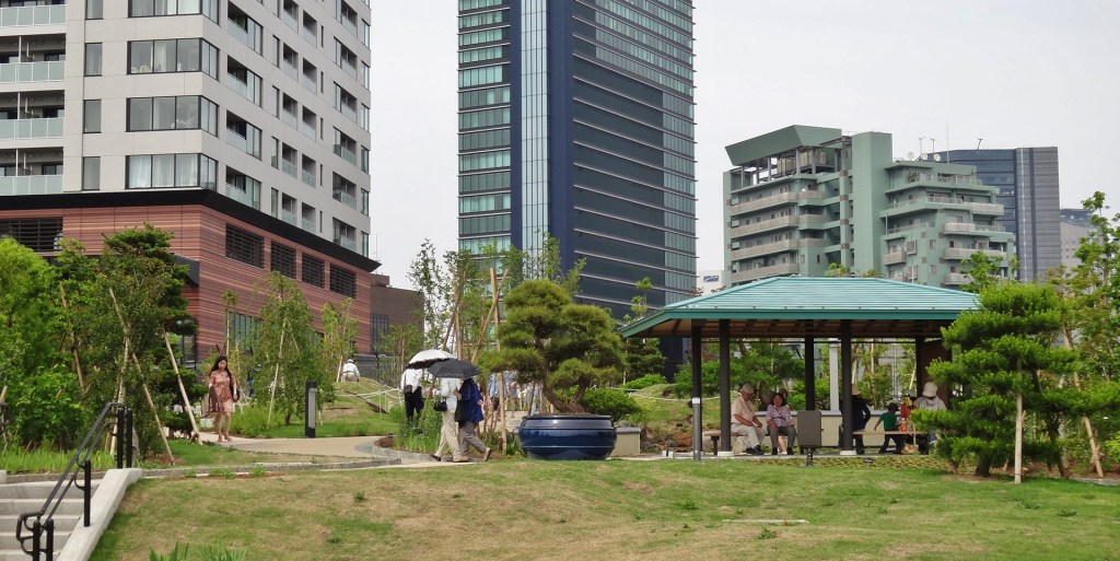
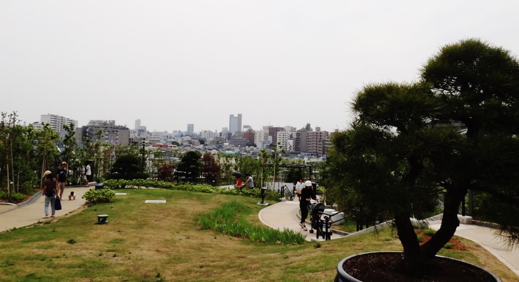
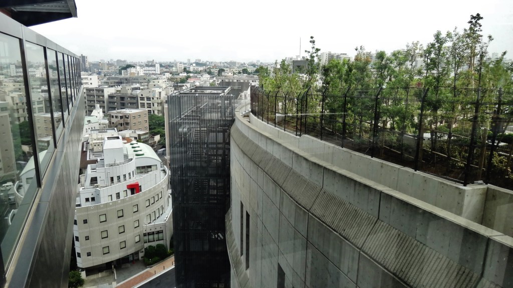
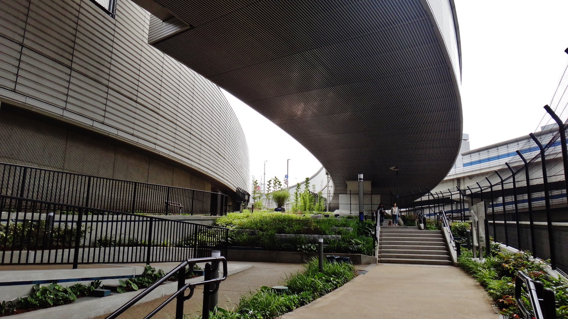
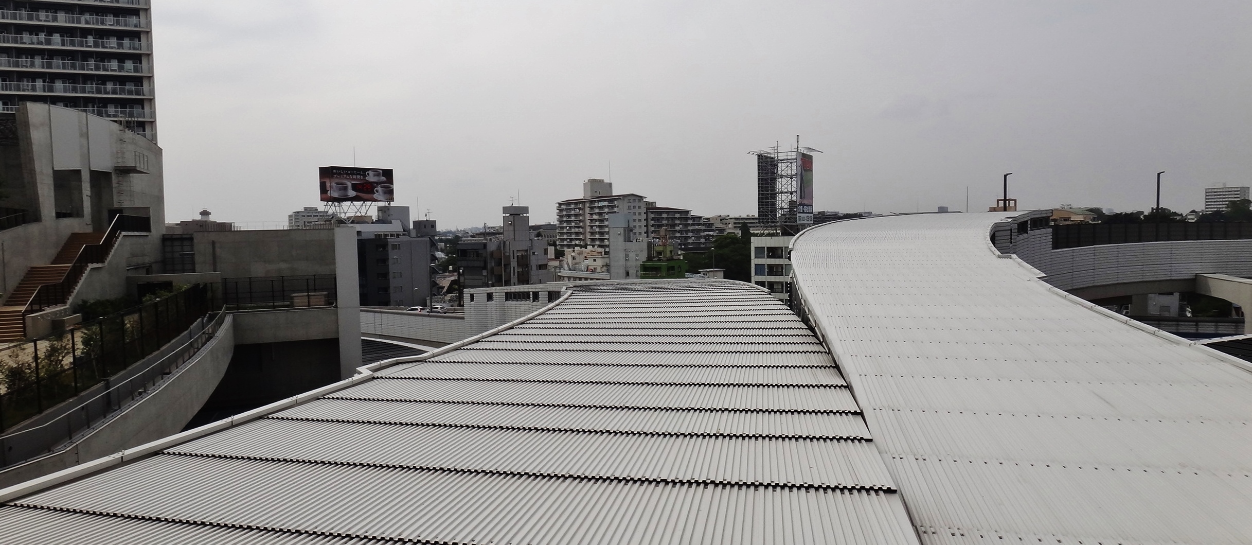
When I visited the rooftop garden in June 2013, I was impressed by how accurately the project had been captured by the artist’s renderings. I took the elevator to the lower end of the roof and followed the path up a gentle slope through the garden. Many people were enjoying the day, sitting on benches or just taking a stroll. Despite the hazy, colorless sky, the grass and trees lent a feeling of warmth, and the park’s elevation provided a feeling of escape from the city.
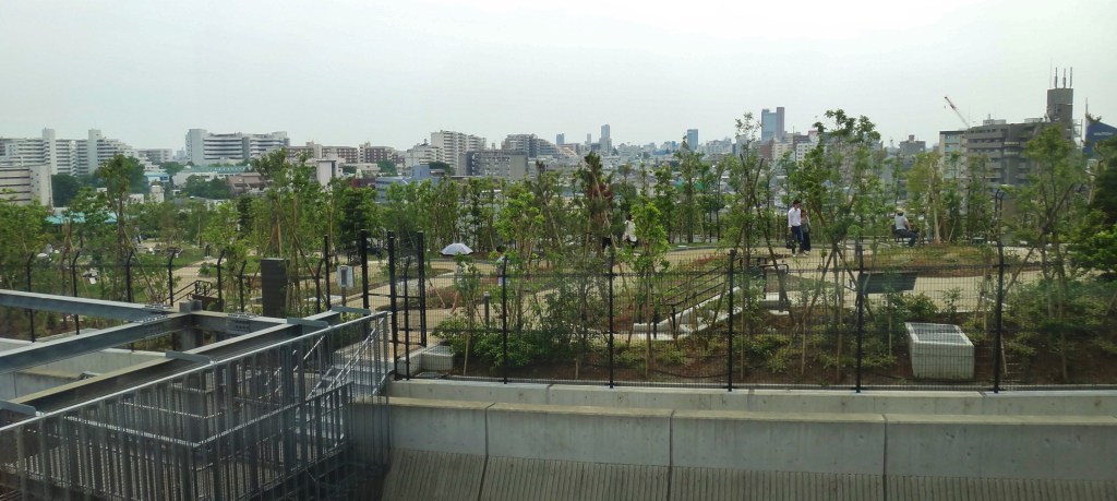
At the “top” of the curve, the path ends at a fence, next to the ventilation system the cleans the air of the highway beneath your feet. On top of the ventilation system are two small pools of water that I mistook for a drainage system (below, left). In fact, it is a “Roof Garden for Conservation of Biodiversity”, known as Ohashi Sato no Mori「おおはし里の杜」. According topromotional materials, the purpose was to “recreate the original landscape of the area, providing local children with the chance to plant rice the traditional way in the green space’s paddy field.”

The bridge to the library
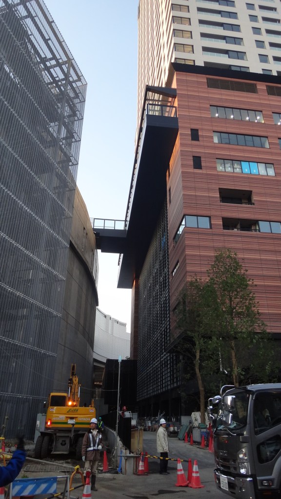
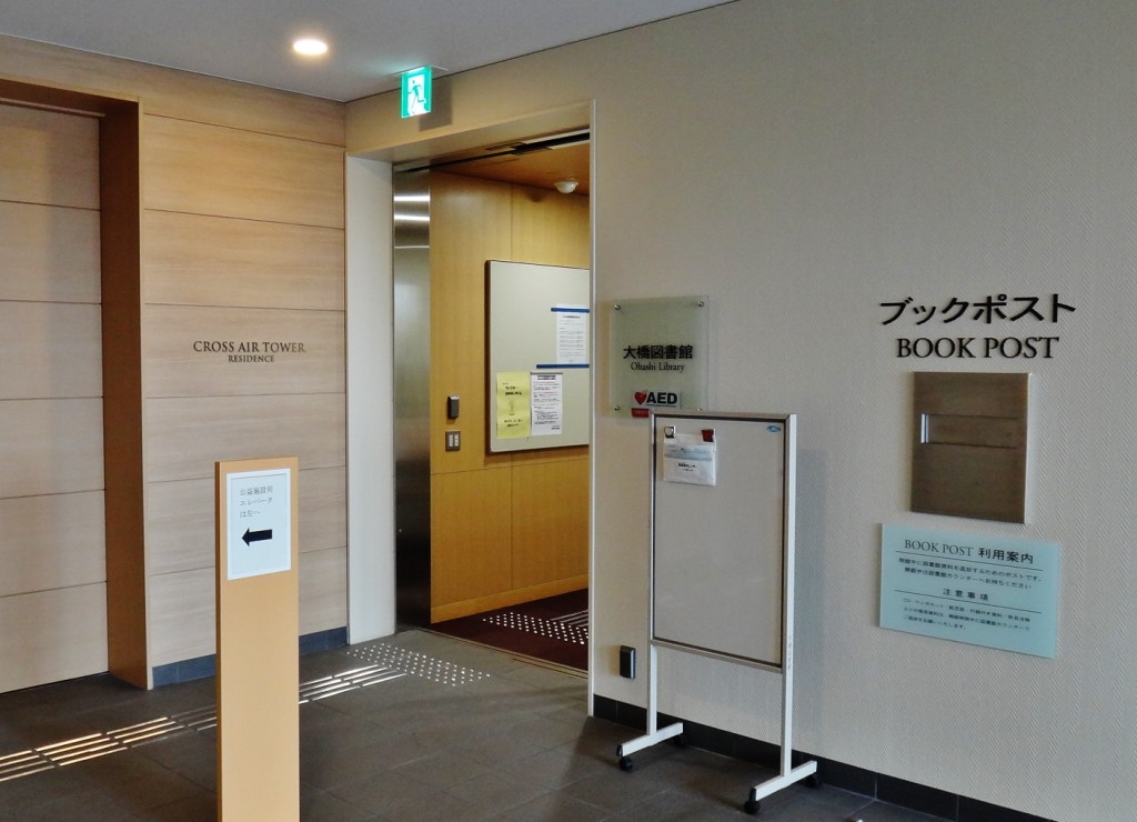
Next to the rice paddy, at the top of the garden, is a short bridge that links Sky Garden to the 9th floor of the Cross Air Tower, a luxury apartment building.
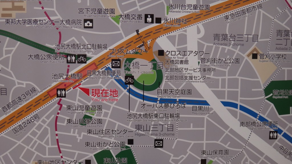
Meguro Ward Bridge Library 目黒区立大橋図書館
Just inside the building, across from the Sky Garden, is a branch of the Meguro city library, open Tuesday through Saturday, 9 am – 7 pm, and Sundays from 9 to 5. See their website for current hours.
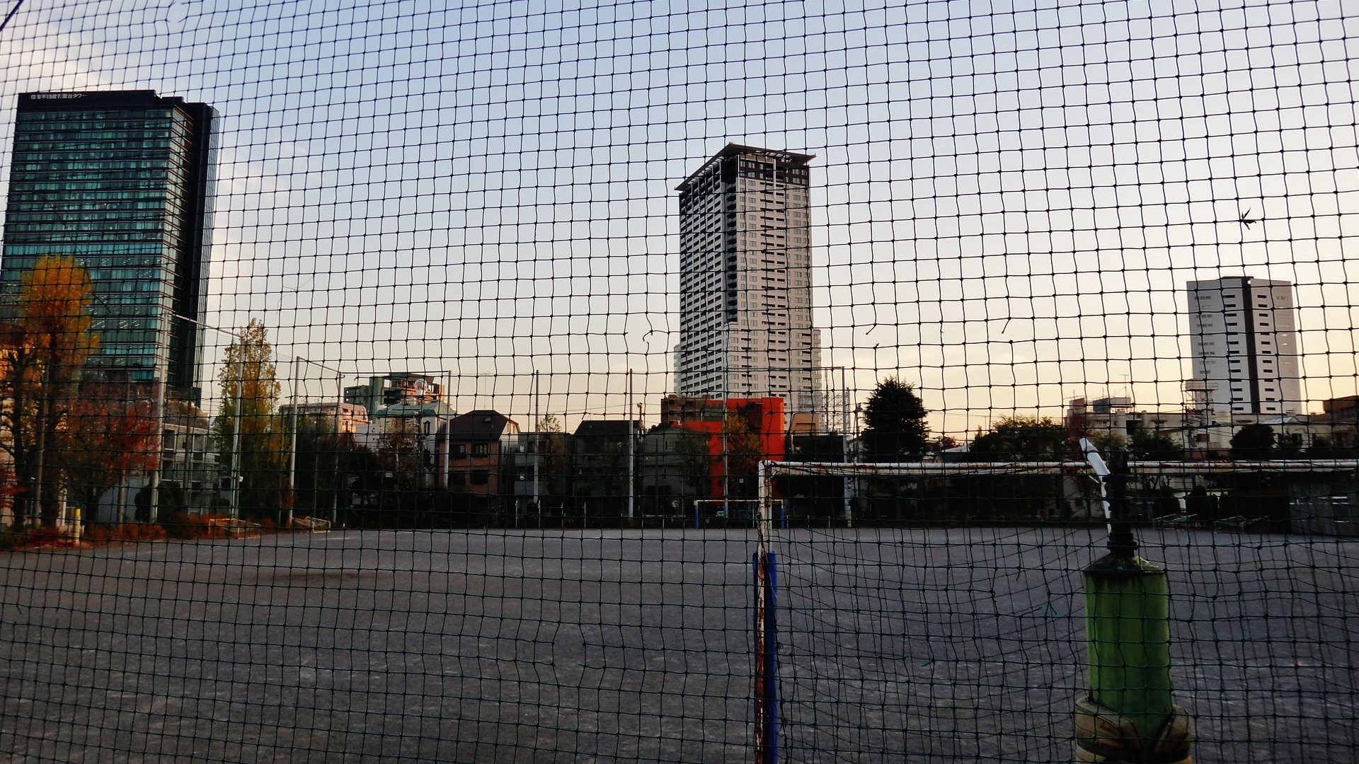
The soccer field: O-Path Dream Square / O-Path YUME Square オーパス夢ひろば / オーパス夢平方.
I took another elevator down from the middle of the Sky Garden to the ground level. In the center of the oval, surrounded on all sides by the massive highway wall, is a soccer field. It was fairly well-used when I visited in June, but I suspect it will gain in popularity as it become better known. According to the Meguro city website, the field is open from 7 am to 7 pm from April-October, and from 7:00 a.m. to 5:00 p.m. from November to March.
For an inside-look, here’s a 360-degree view via google maps: click here.
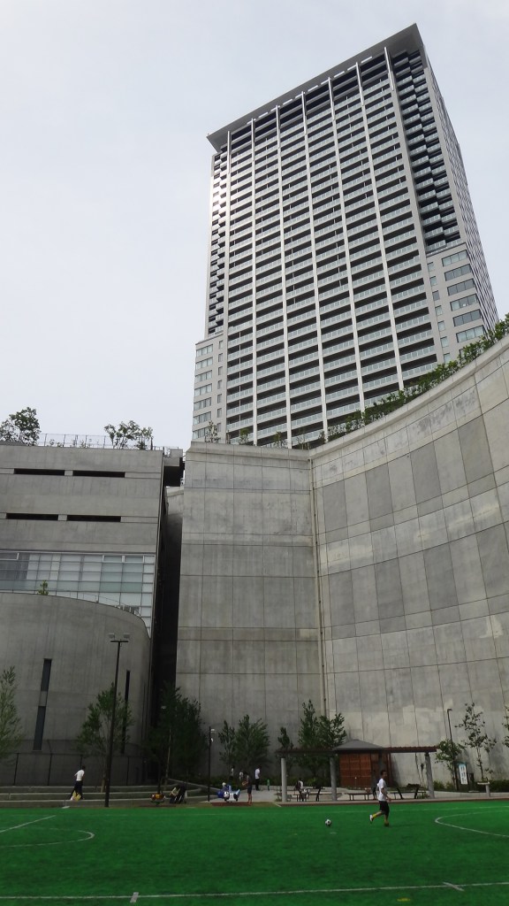
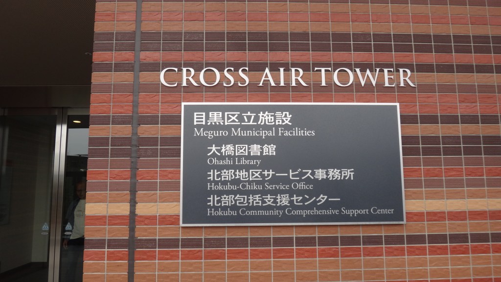
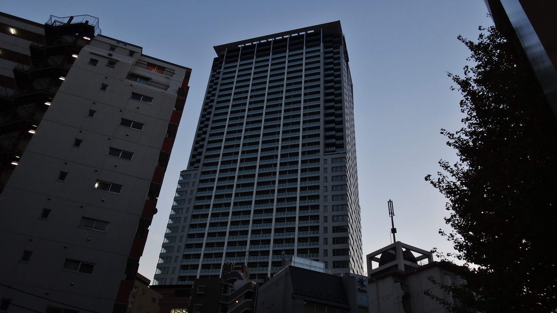
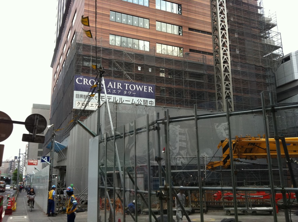
Building 1: Cross Air Tower クロスエアタワー
The Cross Air Tower building is not especially distinctive, but here’s a few pictures so it doesn’t feel left out. Rents for a studio apartment appear to be 130,000 yen per month ($1100 USD), with a 2-bedroom going for 295,000 yen ($2500 USD).
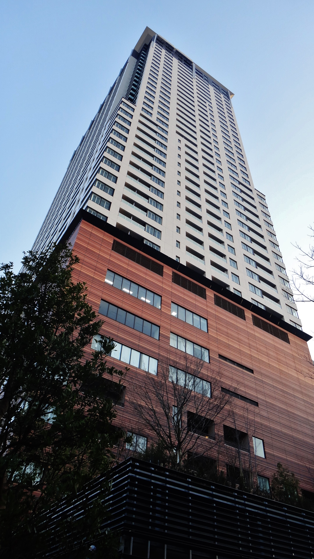
Building 2: Prism Tower プリズムタワー
The smaller Prism Tower (map), is slightly more attractive, probably due to its triangular footprint. Rents are comparable 5 to the other building.
The highway: Metropolitan Expressway Bridge Junction 首都高速道路大橋ジャンクション
Let’s not forget about the highway. After all, it’s why this project exists. What’s most memorable about the highway is that it is hardly noticeable. Even when standing at the top of the Sky Garden, where the highway exits loop, I could hardly see or hear any traffic. Slightly disappointing, in a way, but I’m sure welcome news to the people enjoying the park.

The surrounding area
If you find yourself in Shibuya, I definitely recommend making the short trip to Ohashi Junction to experience this impressive project. After a stroll through the Sky Garden, you can follow it up with a stroll down the Meguro River. The walk downstream (south-east) becomes increasingly beautiful as you draw closer to Nakameguro. From Nakameguro you can easily return to Shibuya via the Toyoko Line 東急東横線.

Alternatively, take the pedestrian bridge north across the street from Cross Air Tower and visit the small shrine (Hikawa Shrine 氷川神社). Behind the shrine are some very peaceful neighborhoods make for good walking.
But in Tokyo, what doesn’t make for good walking?
Links & References, Etc.
See also: the tokyo files: urban design 東京の都市デザイン
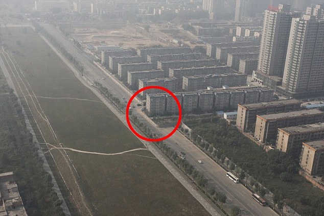
I. Chinese buildings in highways:
- Won’t sell up? Enjoy living in the middle of a motorway! Road is built around a house after elderly Chinese couple refuse to move
- Living in the slow lane: China accidentally builds flats in path of new highway… then has to cut road in HALF
II. Gate Tower Building:
- Gate Tower Building (Wikipedia)
- TKP ゲートタワービル (Japanese Wikipedia)
- Gate Tower Building 6
- Note 1: The Gate Tower Building is now named TKP Garden City Osaka Umeda 「TKPガーデンシティ大阪梅田」 7

- I particularly like this ugly junction in Dallas, Texas:

III. Cross Air Tower / O-Path / Ohashi “Green” Junction 大橋グリーンジャンクション
- Note 2: Other names for the project include “Ohashi Junction Loop Structure Project” and「O-Path(オーパス)目黒大橋」. Confusingly, the katakana word オーパス for O-PATH, is more commonly translated as “OPUS.”
- News from 2007 announcing Prism Tower construction
IV. Rice on the rooftop:

- Meguro Sky Garden 目黒天空庭園
- 目黒天空庭園・オーパス夢ひろばの概要 Outline of Meguro Sky Garden (Meguro City website)
- Vol6. 『O-Path 目黒大橋』まち・みち一体型まちづくり
- No.38 – Environmental Concerns Relating to the Ohashi Junction Loop Structure Project (History & details of project, PDF)
- Urban Development in Tokyo (2011) – Bureau of Urban Development Tokyo Metropolitan Government
- Ohashi “Green” Junction 大橋“グリーン”ジャンクション (Shutoko 首都高 Metropolitan Expressway Company)
- Promotional Materials: Metropolitan Expressway Company, Ltd. Corporate Profile, 2014 (PDF)
V. Cross Air Tower Address
- Ōhashi, 1 Chome−5−1, Tōkyō-to, Meguro-ku 〒153-0044 / 東京都目黒区大橋一丁目 5 番 1号
- Nearest station: Ikejiriohashi / 最寄りの駅: 池尻大橋駅
- The inner workings of the highway junction, part of the Metropolitan Expressway Central Circular Route 8:
VI. Odds & ends:
Footnotes:
- Broken link: benjaminfeenstra com/wp-content/uploads/2011/11/Boston-big-dig-before-and-after-pic jpg ↩︎
- Tokyo Starting to Seek Relief From Its Architectural Cacophony (LA Times) ↩︎
- Negative impact of 1964 Olympics profound (The Japan Times) ↩︎
- Nihonbashi highway is urged to go under (The Japan Times) ↩︎
- Prism Tower プリズムタワー rental listing (Property Bank) ↩︎
- Broken link: asahi com/kansai/travel/kansaiisan/OSK201107210063 html ↩︎
- TKP website: TKPガーデンシティ大阪梅田 ↩︎
- Meguro Sky Garden (Part 1: Ground Level to 5th Floor) 目黒天空庭園(その1:地上~5階) ↩︎
- https://blog-imgs-35.fc2.com/t/a/k/takuya870625/ohashi_jct1s.jpg ↩︎
- https://www.city.meguro.tokyo.jp/shisetsu/shisetsu/koen/tenku.images/tenku_s.jpg ↩︎

[…] Meguro River near Ikejiri-Ohashi station 池尻大橋駅 – for more on that location, see: Planting rice on the highway: Ohashi Green Junction, which describes the intricate highway interchange that is built into the side of condominium […]