Updated a previous post about Todoroki Keikoku (valley) when I learned there used to be a 6-hole golf course nearby during the early Showa period.
Much has already been posted aboutTodoroki Keikoku (valley) 等々力渓谷, akaTodoroki Ravine Park等々力渓谷公園(map), so I’ll stick to what I do best: maps.
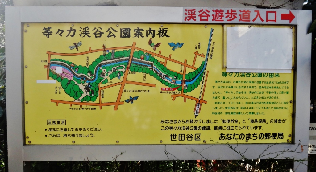
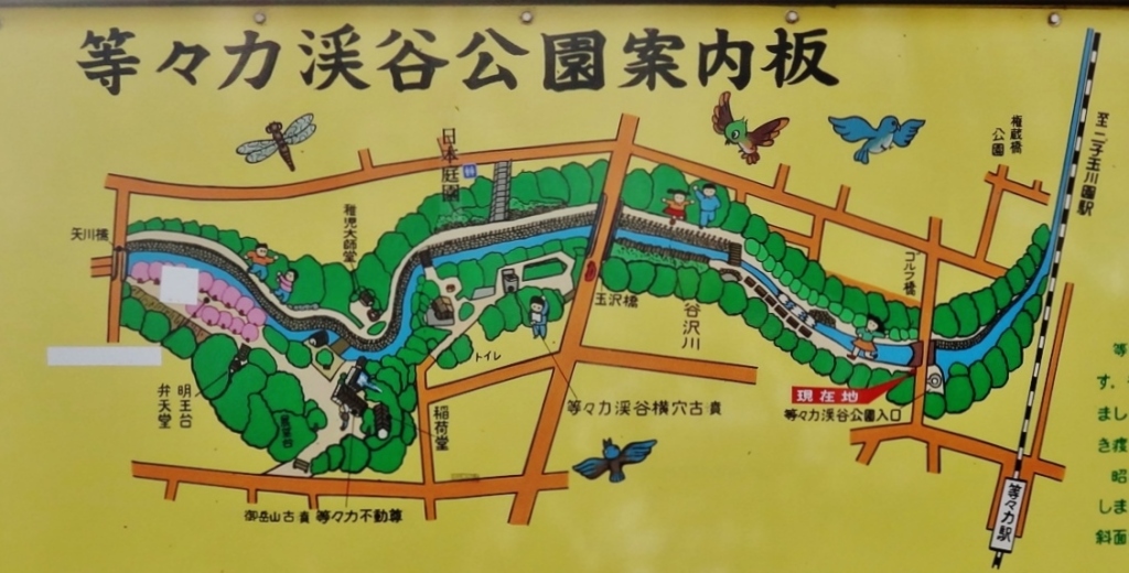
Todoroki Keikoku is a lush, steep ravine cutting through a residential neighborhood on the southern part of Tokyo. It’s especially nice to visit on a hot day, as the temperature in the ravine can be noticeably cooler that at street-level. In addition to a peaceful path along a river, the valley includes a temple and other points of interest:
The main features of this map include:
- (1) TodorokiStation等々力駅 (map)
- (2) Stairs that descend from street to the valley stream (map)
- (3)日本庭園等々力 (Nihon teien todoroki) Japanese garden Todoroki (map)
- (4)等々力不動尊Todorokifudo (temple) (map)
- (4b) At the bottom of the temple, along the river valley, is a small waterfall
- (5) Cherry treesare south of Todorokifudo and can be seen from…
View original post 259 more words
