March 2023 update: new Tobu Hiking website; https://www.tobu.co.jp/odekake/hiking/
I haven’t used these yet, but this website and maps from the the Tobu Railway company look pretty good. Now that the warm spring weather is here, I plan on trying one of these hikes this season. In the attached google map, the hikes listed in this post have red flags. The hikes appear to be concentrated in Gunma 群馬県 and Tochiki prefectures 栃木県. That may sound far, but about half of the hikes are an easy-ish day trip from Tokyo.
Hiking maps
Clicking on the links listed below will take you to the Tobu site. On each page, click on the brown bar with “PDF” in the middle (see example to right). This will bring you to a PDF map of each course. The complete list is also here, and corresponds to the red flags on the map above. See: www tobu co jp/playing/hiking/shizen/ (broken link)
Train directions
For directions to each hike, use the google map above, find the hiking course, and use the google map directions function. Some of these hikes are less than 2 hours from Tokyo, and less than 1000 yen each way.
List of Tobu line nature hikes, with links 東武線沿線 自然ハイキング(コース一覧) :
(Broken links as of March 2023)
- 戦場ガ原(日光線 東武日光駅) Battlefield moth Hara (Nikko Line Tobu Nikko Station) tobu co jp/playing/hiking/shizen/senjogahara/
- 切込湖・刈込湖(日光線 東武日光駅) Kirikomiko-Karikomiko (Nikko Line Tobu Nikko Station) tobu co jp/playing/hiking/shizen/kirikomiko/
- 半月峠(日光線 東武日光駅) Half moon Pass (Nikko Line Tobu Nikko Station) tobu co jp/playing/hiking/shizen/hangetsutoge/
- 中禅寺湖南岸(日光線 東武日光駅) South of the Lake Chuzenji (Nikko Line Tobu Nikko Station) tobu co jp/playing/hiking/shizen/chuzenjiko/
- 霧降高原(日光線 東武日光駅)Plateau (Nikko Line Tobu Nikko Station) tobu co jp/playing/hiking/shizen/kirifurikogen/
- 鳴虫山(日光線 東武日光駅) Nakimushiyama (Nikko Line Tobu Nikko Station) tobu co jp/playing/hiking/shizen/nakimushiyama/
- 日光探勝(日光線 東武日光駅) Nikko Tansho (Nikko Line Tobu Nikko Station) tobu co jp/playing/hiking/shizen/nikko/
- 尾瀬(会津鬼怒川線 会津高原尾瀬口駅) Oze (Aizukinugawasen Aizukogen Oze mouth station) tobu co jp/playing/hiking/shizen/oze/
- 龍王峡(会津鬼怒川線 龍王峡駅) Ryuokyo (Aizukinugawasen Ryuokyo station) tobu co jp/playing/hiking/shizen/ryuokyo/
- 奥鬼怒(鬼怒川線 鬼怒川温泉駅) Back Kinu (Kinugawasen Kinugawa Onsen Station) tobu co jp/playing/hiking/shizen/oku_kinu/
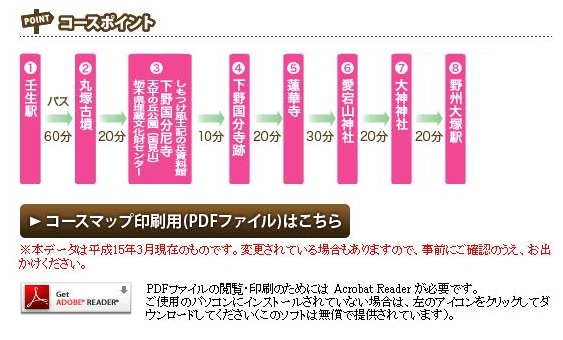
- しもつけ(宇都宮線 壬生駅) Servants put (Utsunomiya Mibu station) tobu co jp/playing/hiking/shizen/shimotsuke/
- おもちゃのまち(宇都宮線 おもちゃのまち駅) Omochanomachi (Utsunomiya Omochanomachi station) tobu co jp/playing/hiking/shizen/omochanomachi/
- 太平山(日光線 新大平下駅) The Peak (Nikko Line Odaishita new station) tobu co jp/playing/hiking/shizen/ohirasan/
- 板倉西(日光線 板倉東洋大前駅) Itakura west (Nikko-sen Itakura Oriental Omae station) tobu co jp/playing/hiking/shizen/itakura_nishi/
- 渡良瀬(日光線 藤岡駅) Watarase (Nikko Line Fujioka Station) tobu co jp/playing/hiking/shizen/watarase/
- 赤城(桐生線 赤城駅) Akagi (Akagi Kiryusen station) tobu co jp/playing/hiking/shizen/akagi/
- おじま(伊勢崎線 木崎駅) Ojima (Isesaki Kizaki station) tobu co jp/playing/hiking/shizen/ojima/
- 太田(伊勢崎線 太田駅)Ota (Ota Isesaki station) tobu co jp/playing/hiking/shizen/ota/
- 唐沢山(佐野線 堀米駅) Karasawayama (Sanosen Horimai station) tobu co jp/playing/hiking/shizen/karasawasan/
Happy hiking!
P.S. The other colored-dots on the map:
- Purple: Town walking courses タウンウォーキング(コース一覧)
- Green: Hiking in Chichibu 東上線沿線 外秩父ハイキング(コース一覧) (broken link: tobu co jp/playing/hiking/sotochichibu)
