
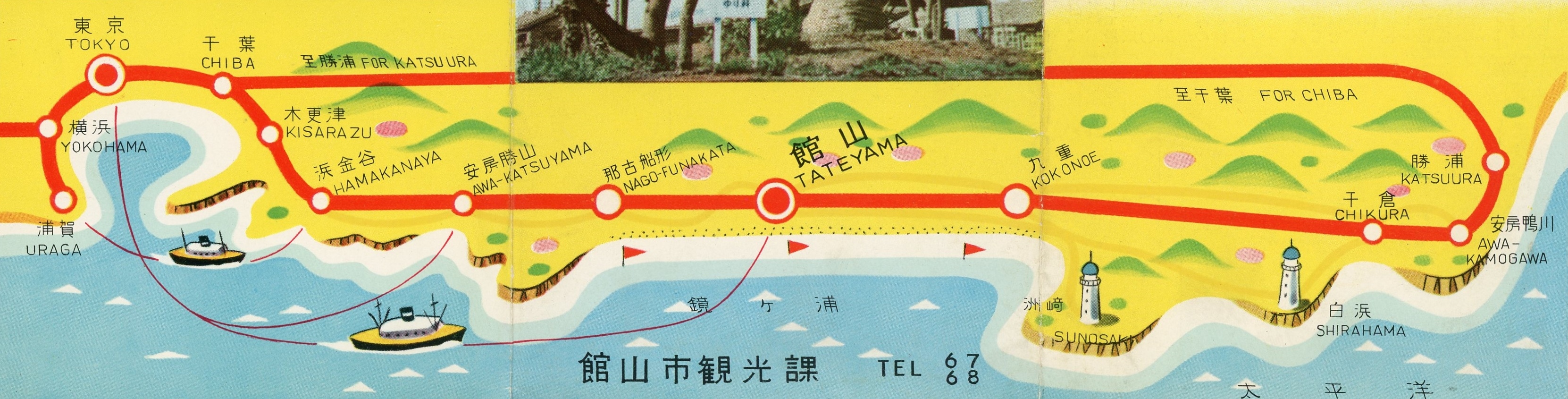
Tateyama 館山, at the southern tip of Chiba’s Bōsō Peninsula 房総半島 (map) is probably overlooked by most Tokyoites. Too close for vacation, yet too far for a day trip to be convenient. I’ve never been. But now I want to, courtesy of a vintage tourist brochure I picked up at a Shimbashi flea market.
Sand skiing サンドスキー
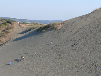
The most amusing part of the brochure is a picture of sand skiing. It’s captioned 砂山, which means sandpile (sunayama).
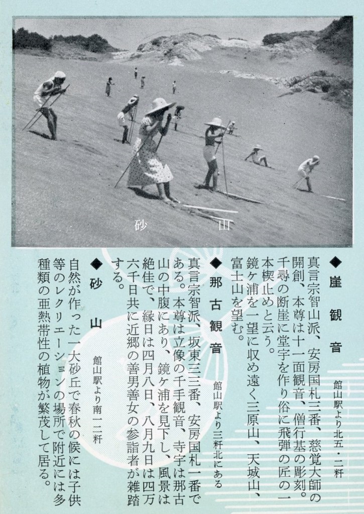
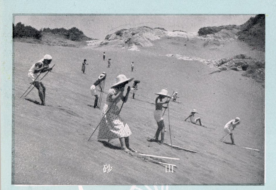
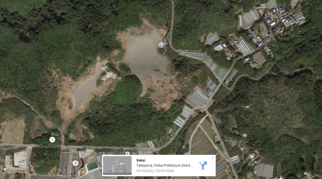
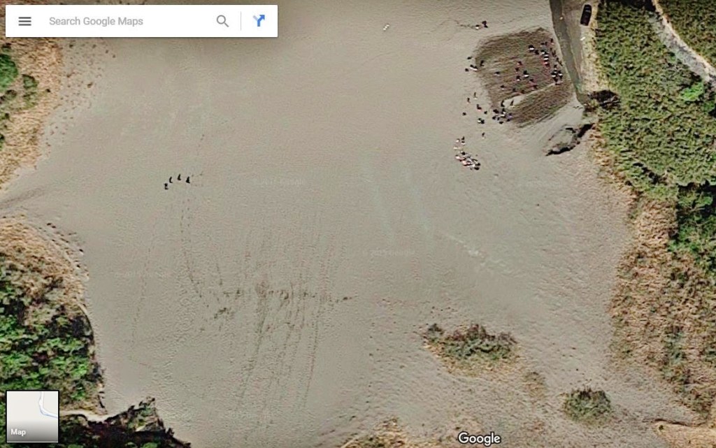
I thank these old-timey sand skiers for letting me know about this diversion. The Tateyama city website (in Japanese) provides information and directions to the sand skiing site. As seen in satellite images, the sand still gets good use. The dunes are situated just north (inland) of the Tateyama Country Club 館山カントリークラブ. There are two slopes, both located here (map).
Here’s a brief video:
And after a day of sand skiing, you’ll probably want to cool off at the beach. Or you may want to skip the sand skiing entirely…
Getting to Tateyama
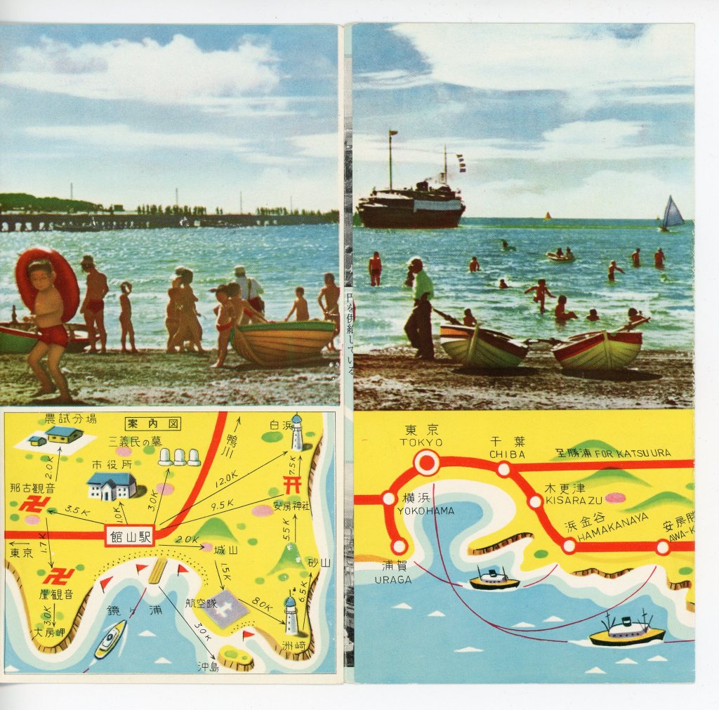
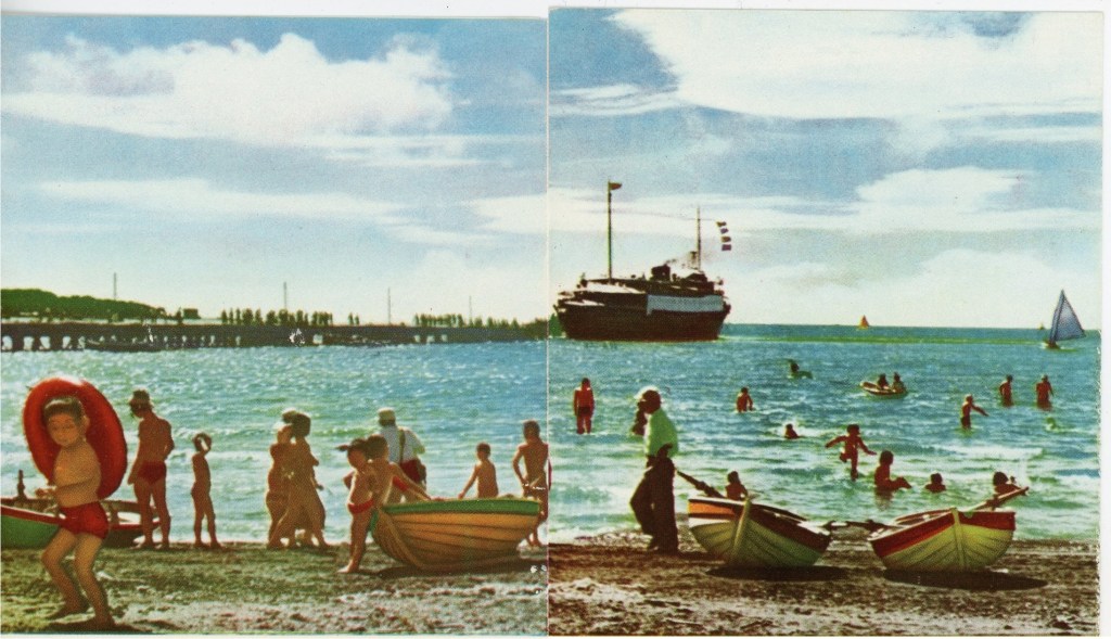
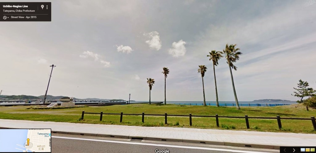
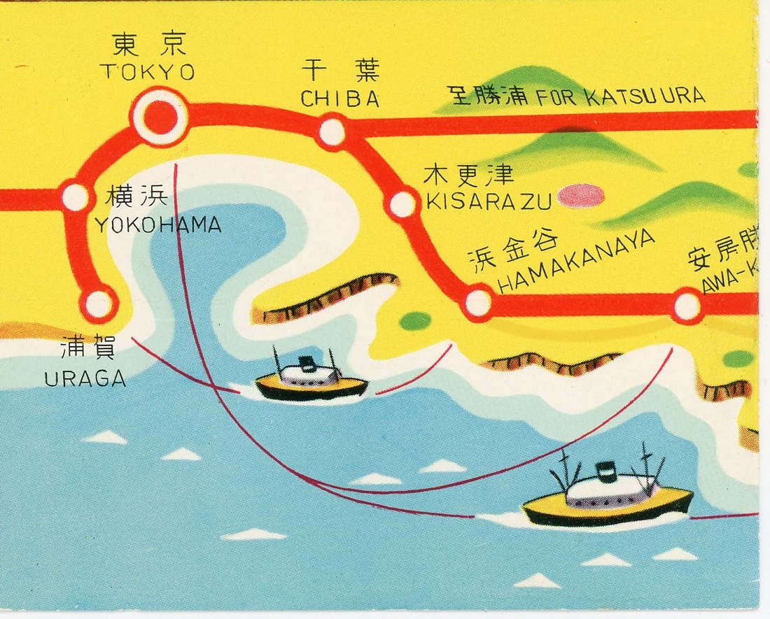
There used to be a ferry from Tokyo to Tateyama (pier seen above), but today it’s a little more complicated. You can recreate some of the magic by taking the Tokyo Wan Ferry from Kurihama 久里浜 (south of Yokohama) to Kanaya 金谷, in Chiba (map). It takes 35 minutes from Hama-Kanaya Station 浜金谷駅 to Tateyama Station 館山駅 via the Uchibo line 内房線. The beach scene in the brochure is located approximately here (map).
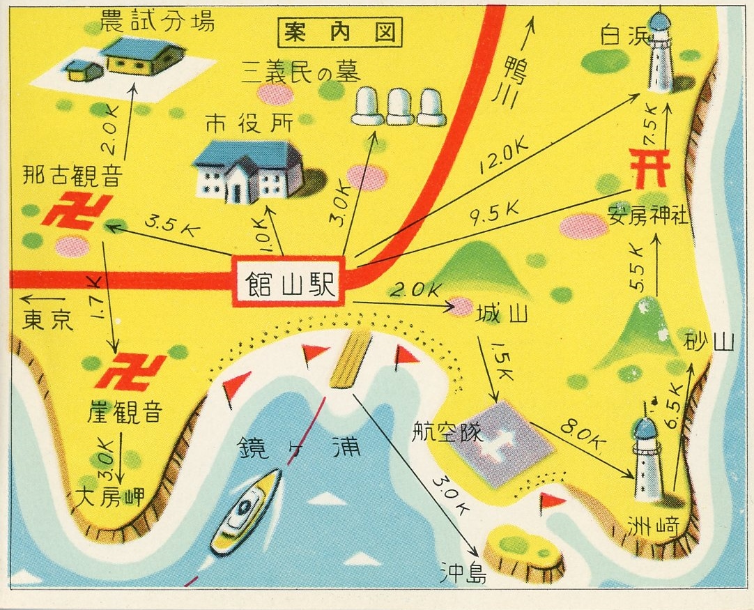
Map detail:
Links & Resources:
- Sand dune information, from Tateyama City
- Blog with pictures
- Sand Sports Japan
- Tateyama sand dune site map:

Sand skiing in the rival Izu Peninsula:
- Izu Peninsula Sand Skiing (Touji Sand Skiing area 田牛サンドスキー場) (map)
The really big sand dune in Japan: Tottori Sand Dune 鳥取砂丘
- Tottori Sand Dunes 鳥取砂丘 (aka “Japan’s Desert”) (map)
Elsewhere in Chiba Prefecture:
- Rampage Swamp and the River of Flowers 花見川とあばれ沼
- Yamaman Yukarigaoka Line maps 山万ユーカリが丘線
- Timeless fields of Abiko-shi, Chiba-ken
- Sakura city, Chiba: De Liefde Friendship Windmill

[…] Sand skiing in Tateyama, Chiba 館山のサンドスキー […]