Of the many dozens of rivers in the Tokyo area, likely all of them have undergone man-made changes over the years.
In particular, many rivers were straightened in the decades following World War II in an attempt to tame floodwaters (and perhaps also to make property development easier). I’ve noticed that several danchi (public housing complexes) were built on the land resulting from river-straightening projects, such as this example along the Shakujii-gawa 石神井川 in Nerima-ku (map):

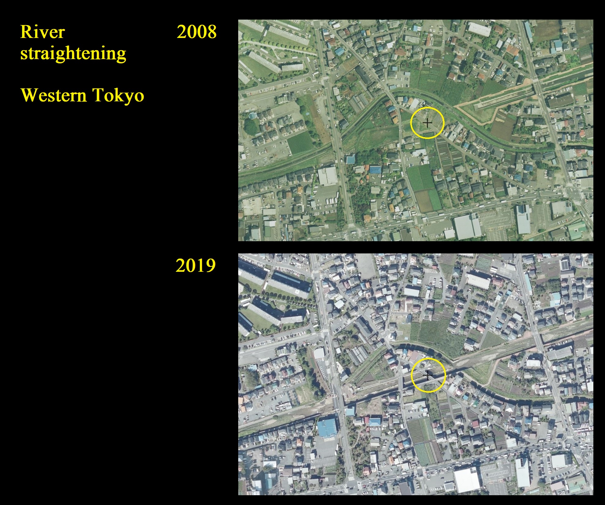
While river-straightening is not rare in Tokyo, what is uncommon is to see recent examples, as most of these projects were completed decades ago.
But take this recent / ongoing example of a river-straightening project in Western Tokyo (Higashiyamato 東大和市), which is changing the path of the Karaborigawa river 空堀川(からぼりがわ) (map).
An aerial view of the river in 2008 and 2019. You can see the curve of the original river above the reference point circled in yellow:


Comparison view:
And here’s what it looks like from the ground (facing east):


Plan (source):

Note: there are various terms used to describe the process illustrated above, including:
- River straightening
- River engineering 河川工学
- Channelization
- Channel straightening
See also:
- Splashing around Tokyo’s water infrastructure
- Land Readjustment Projects 土地区画整理事業
- Zenpukujigawa river 善福寺川 (formerly prone to flooding, which has since been straightened)
- 【第8期】第1回柳瀬川・空堀川流域連絡会 全体会議事録 [8th term] 1st Yanase River/Karabori River Basin Liaison Meeting – General meeting minutes (PDF)
- Overview of Tokyo’s urban design
- The Tokyo Files: River Glossary

[…] many danchi, the land it abuts is a river that underwent river straightening circa 1950. Here is a series of aerial photographs of the site circa 1940, 1950, and […]
[…] is a small branch of the Ochiai-gawa 落合川 river; the nearby main branch of the river underwent river straightening sometime in the last few […]